 |
Main Menu
Home
News
Events
Bulletin Board
Admin Corner
Chapter Officers
Chapter History
LTC Buckley
Taps
Deceased
Members
Deceased
Friends
Reminiscences
Scholarships
Chapter Coin
Quartermaster
Store
Teamhouse
Links
Contact Info
Chapter 54 Member
Participates in GB Fundraiser
on Appalachian Trail
Special Forces Association Chapter 54 member Ling Wong recently took part in a fundraising effort to raise money for the Green Beret Foundation by hiking a portion of the Appalachian Trail (AT). A group of former Green Berets decided to raise money for the organization by having Special Forces men do a 'relay team' hike of the entire AT. One team started from the south end in Georgia and the other team started from the north end in Maine. Each team consisted of many individuals who hiked parts of the trail in relay fashion. The US Army Special Forces veterans hiked the trail to support their brothers and families. More info on this fundraiser is found on the events website:
Green Beret Appalachian Trail Walk & Fundraiser
www.greenberetat.org
Ling Wong hiked a 60 mile stretch of the trail in Vermont and Massachusetts in July. His account of the hike and some pictures is provided below.
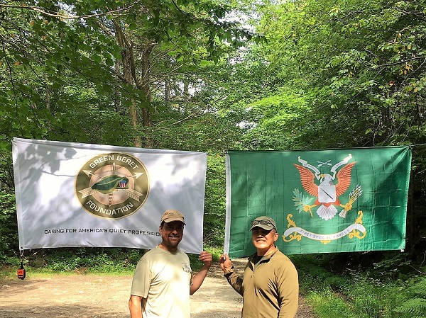
Sean McNeal and Ling Wong (on right) on Appalachian Trail with
Green Beret Foundation and Special Forces Regimental Flags.
McNeal passed the flags to Ling in Vermont.
The idea of a relay along the length of the Appalachian trail from Springer Mountain Georgia, to the summit of Mt. Katahdin in Maine by former and current Special Forces Soldiers started as an off-hand comment on a social media group. A former SF soldier, Johnny Mullin, suggested the relay to raise money for the Green Beret Foundation, a number of people (including myself) thought it was a great idea and offered to do sections nearest to where we lived. Before long Mullin stood up a website to promote the relay, including a Facebook group for people who wanted to participate. Mullin and Tom Merrill administered the Facebook group, others offered to coordinate commo or logistics, an OPORD was created to define how the relay would be conducted, and the relay was split between north bound (NOBO) and south bound (SOBO) groups. There are two generally defined types of hikes that transverse the Appalachian Trail. Through hikers (people who travel the entire length of the trail, approximately 2200 miles, over a continuous 4-6 month period of time), or section hikers (people who do the trail in sections over a non-contiguous period of time, typically years). The relay was created as a series of north bound and south bound section hikes that different teams would do until they meet at the Appalachian Mountain Club’s Mohican Outdoor Center in Blairstown, New Jersey.
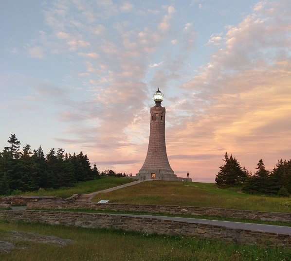
Mount Greylock War Memorial in Massachusetts on the Appalachian
Trai
While doing 20-30 mile sections of the Appalachian Trail is very manageable, getting enough people to do all the sections from Georgia to Maine proved to be daunting. Most of the volunteers were clustered in certain states, logistical support in the Northeast was sparse, though that was somewhat mitigated by the fact that there is a higher density of towns along or near the trail in the Northeast. Still there were gaps and limited numbers of hikers, partly because many members of the SF Brothers group on Facebook are still on active duty, and others had health issues that prevented them from hiking. So some of the hikers on the relay, JC Heit, Will Melton, Johnny Mullin, Devin Plaskiewicz ended up doing multiple sections of the trail, often alone (Melton hiked hundreds of miles by himself, Plaskiewicz covered New Hampshire). Omar Carcamo flew up to Georgia from Florida to hike several sections with his wife Jennifer because of an injury to another hiker. It was an extraordinary effort to accomplish this, and I include those who provided logistical support along the way. The logistical teams would assist hikers with INFIL or EXFIL from the AO, resupply, emergency medical evacuations, and in some instances to allow the hikers to “slack pack” by off-loading food, tents, etc, so that the hikers can move faster over the difficult terrain. Originally, I was going to do one section that crossed from Vermont to Massachusetts with another member, there was another section in Massachusetts that had no hiker so I volunteered to do that one by myself. As it ended up, there was a miscommunication and I ended up doing both sections from the Seth Warner shelter in Vermont to Tyringham, Massachusetts by myself, about 60 miles on the trail.
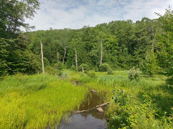
Part of the Appalachian Trail
People who know the terrain of Western Massachusetts and Southern Vermont, know that while the elevation is modest, much of it is a muddy, root covered rockscape, Since I was traveling alone, I decided to try and complete it over a long weekend. My plan was to get down from the elevation of Bennington, Vermont to the border of Massachusetts as quickly as I could and ascend Mt. Greylock, the tallest peak in Massachusetts (3491 feet) by the late afternoon of the first day. As it was, the approach was going to be a slog no matter what (it is a pretty steep climb from North Adams to the summit) and my plan was to hit the Mark Noepel lean-to for the night, about 3.3 miles further up the trail from where I ended that day. Things happen on the trail, and I gimped myself up pretty good about 2 miles into my hike coming down a rock scramble from Vermont. There are parts of the trail as you descend towards the Massachusetts border from Vermont that are steep rock falls, I stepped on a wobbly slime covered rock and I ended up splattering myself, wrenching my knee as I tried to stabilize myself and my 40-pound plus rucksack (when I learned at the last moment that I would be hiking the two sections alone, I modified my packing list and ended up overloading with gear).
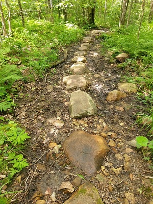
Part of Appalachian Trail
2 miles into my hike and I couldn't put any weight on my left leg, hopping around like an angry goat trying get down the rock fall. This was where I came to the decision that my trekking poles were the best $100 I ever spent on gear. Still, for the rest of my descent, I was like a giraffe on roller skates, not quite able to apply pressure to my leg with only a limited range of motion in my left knee, and I still had about 58 miles to go.
There were so many thoughts in my head as I finally reached the Massachusetts border and started towards North Adams. One of them was whether or not I should continue, my pace had slowed considerably and my plan was to cover the 60 miles in about 72 hours. That way I would hit certain shelters along the way. At the pace I was moving, I was not certain that I would be able to stick to my plan or if I would be able to do it at all. Thing about it is that there was no one to take my place, others on this relay had sacrificed so much to get as far as we did, there was only about 500 miles separating the north bound and south bound teams. I was just a small part of it, but I did not want to let people down. So...I just kept putting one foot in front of another and kept moving south.
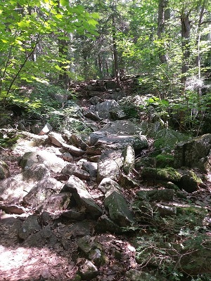
Part of Appalachian Trail
It was nightfall when I finally got to the summit of Mt. Greylock, as the mountain went dark, I ambled into the lodge to get a meal and mulled about amending my plans or somehow getting back on track over a beer and beef stew that they served that night at the lodge kitchen (which really improved my mood), tomorrow was another day and I'm 13+ miles closer to Tyringham, MA.
When I got up
the next morning, I was a bit more sore and my knee has puffed
up nicely - not unexpected, but I have never had edema in my
knees before - not like this. I stayed long enough to get
breakfast and another hiker who was summiting the highest peaks
in 30 different states accompanied me for the next 3.5 miles to
the Noepel Lean-To, his company made the walk much more
pleasant. We separated near the trail junction of the lean to,
as he turned back towards the summit. The town of Cheshire, MA
was just 7 more miles ahead of me. Walking on the Berkshire
plateau allowed me to make up some miles, but not enough to
completely get back on track.
Perhaps the most enduring thing that remains with me about
hiking the Appalachian Trail is the interactions with people.
They are of all ages, some on their own, others in large
groups, seemingly bound together by this journey we are all on.
It is striking how willing strangers are to provide help to
others, the dedication of those who volunteer to maintain the
trails, the anonymous kindness of the many trail angels who
leave food, water and even offer shelter at road crossings,
somewhere along the way, you might also learn something about
yourself and your willingness to live by your words and
promises to others. It brought me back 30 years to a time when
I shared a uniform with people who I have come to see as
brothers. What started as something of someone’s musing about
doing a hike, became something very real to raise money for the
Green Beret Foundation (it is about $30k right now and we are
still taking donations), it speaks to something about ourselves
and those of us who were and always will be Green Berets.
DOL
Ling Wong
|
Serving Green Berets 
 |